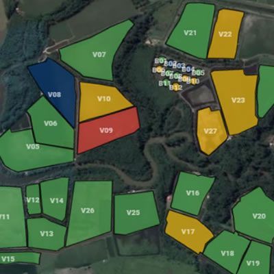
We built a totally intuitive tool to delimit and identify your nurseries and their status and updated production details.

Google Maps
Accuracy and trust in the best known and most used geolocation technology in the world.
We built an intuitive tool with which you can demarcate the boundaries of your nurseries yourself. In addition to the initial purpose of identifying your nursery, we also calculate its area very accurately.

Overview of your farm
From your home screen, view the status of your nurseries. Find out which ones are populated or in preparation.
After demarcating your production centers (nursery, raceways and nurseries) and correctly entering information such as the dates of your cycles and your stands, follow the status of each production center on your home screen.

Agile information
With just one click, access summaries of information for each nursery on your home screen.
Keep track of information such as: current cycle start date, preparation and fattening days, populated quantity, area and density. If they have already been entered, also have the last biometry and survival information and, therefore, the estimated biomass.
